Attending the PhD Summer School on Remote Sensing for Wind Energy at the Institute of Wind Energy at the Denmark Technical University (DTU Riso) in Roskilde, Denmark.
Day 1 focused on LIDARs. It included a walk to check out the historical met mast and a view of the wind turbines (see images).
The ocean is a complex system as a result of coupled forces arising from fluid dynamics. This coupling of the difference forces in the ocean (currents, surface and internal waves, swell, etc…) and the rotating Earth result in a sea surface with complex features obscuring the depths of the ocean.
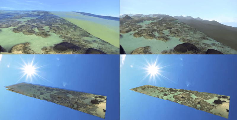
Utilizing machine learning NASA AMES research scientist Ved Chirayath devised a method called fluid lensing to reduce and make these effects almost negligible. This resulted in a fluid cam capable of peering down to a depth of 10 meters which makes it very useful for studying coastal and coral systems.
I quote from NASA’s website:
So far Fluid Cam, the imaging instrument that carries the fluid lensing software, has flown only on a drone. Someday, this technique could be flown on an orbiting spacecraft to gather image data on the world’s reefs.
So far the only way to get any information about the interior of rocky planets was from the moment of inertia which is related to a planets mass distribution. This only allowed to estimate if a planet has a mantle and what the estimated thicknesses of the core and mantle are. Of course, other (remote sensing) methods like potential (gravity and magnetic) fields can also give more information about a planets interior. However, the only solid way to determine the layer interface and their depth and thicknesses is seismic imaging, a popular technique used to image Earth’s subsurface and interior.




You must be logged in to post a comment.