An earthquake is the result of a sudden release of “strain” that is built-up between two tectonic boundaries or at a fault line*, usually slipping in opposite directions.
The following video by the California Academy of Sciences shows a computer simulation of an earthquake at the Hayward fault which is one and the most concerning of several faults in California. The most famous fault being the San Andreas fault.
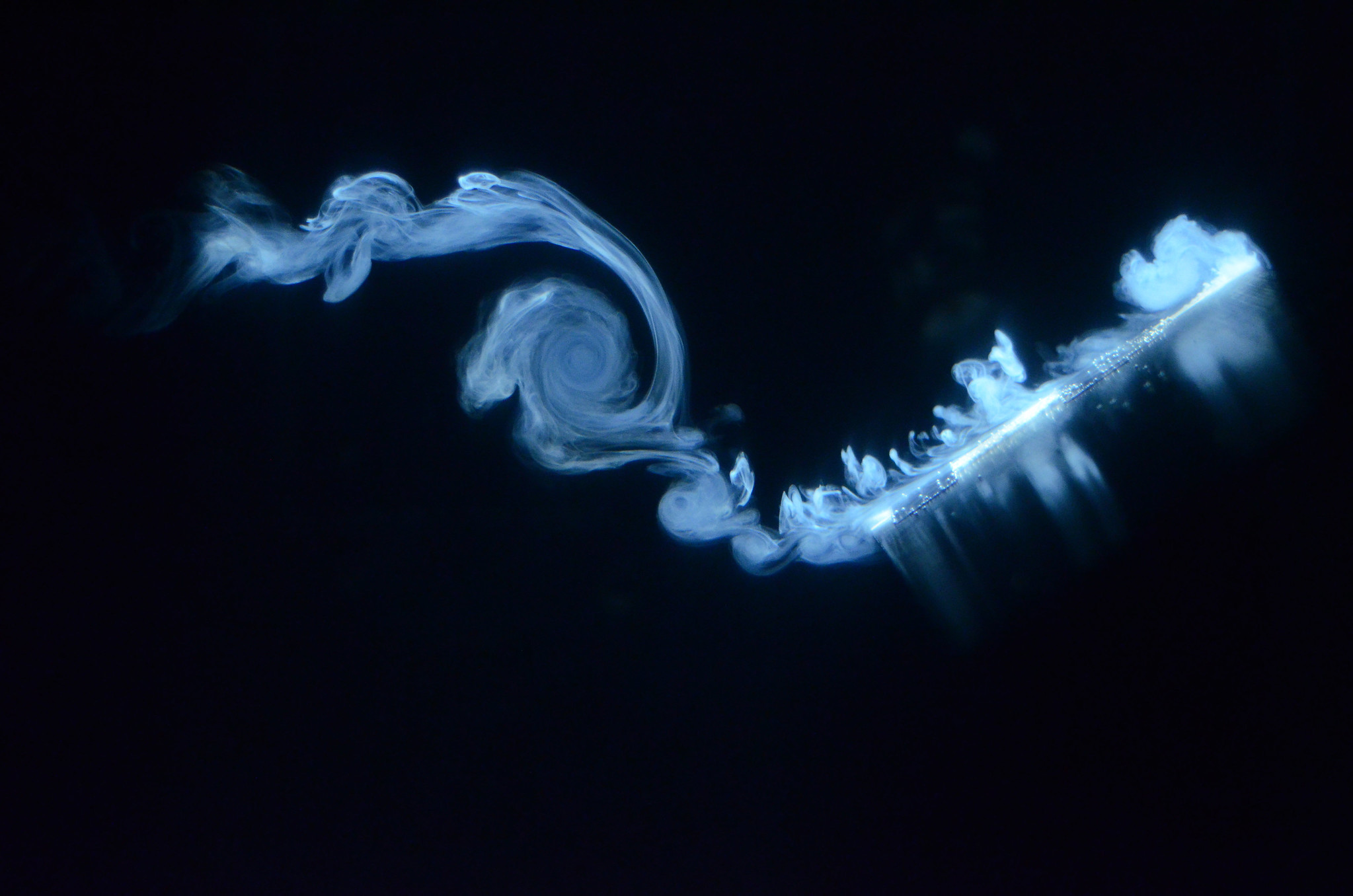
Robbie Stevens: Flat plate vortex formation at low Reynolds number
The Photograph shown is the raw image with no alterations. The image depicts a flat plate wing, which is simultaneously pitching and translating rapidly over a short distance through water at a Reynolds number of 10,000. This work is targeted towards understanding the aerodynamics of small insects with an intended application for Micro-Air Vehicles. The vortices are visualised by injecting a dye composed of milk and water. The milk has good reflective properties and is neutrally buoyant so follows the real flow faithfully. The inspiration for using milk came while pouring milk into a cup of tea at breakfast one morning! The photograph was taken by myself using a Nikon D7000 digital SLR camera, with the shutter speed and ISO adjusted to maximise the light entering the camera and allow the vortex structures to have a high contrast against the background. There are reflections of the vortex structures on the surface of the wing and some air bubbles are also visible on the dye injection needle on the wing’s surface.
It was recently discovered that a small asteroid has been in a stable orbit around Earth for at least a decade. The nature of its orbit “prevents the asteroid from approaching much closer than about 38 times the distance of the moon.”.
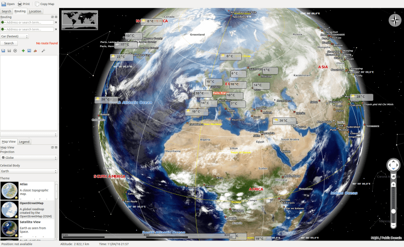
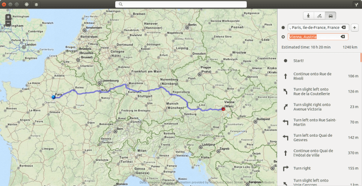
Everyone uses digital maps these days, I assume. At least I do. Since I’ve been using them more often lately, I checked if there are any apps for Linux and especially Ubuntu. The search returned 4 apps.
Maps (aka gnome-maps)
is a map application for GMONE. Its use is slick and fast. It is supposed to be simplistic
Search and directions is functional (based on MapQuest if I’m not mistaken) but geolocation isn’t. Moreover, the satellite imagery is not available at high resolution.
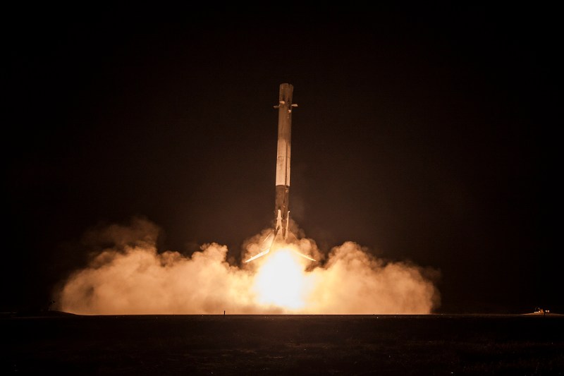
For some reasons I missed the live cast of the launch and landing that SpaceX did.
Here’s the deal in short. They launched the Falcon 9 rocket into space, passed the maximum Q at which aerodynamic pressure is at its highest and could cause serious trouble to any rocket.
Following the detachment of the stage 1 booster and the ignition of the 2nd stage booster, and this is the phenomenal feat they did, the stage 1 part made an acrobatic flip, made the appropriate adjustments to put itself on the right trajectory to return to land and actually do a(n) (experimental) landing (occurs at 32m 20s). The goal of this is pretty obvious, a reusable rocket.
The second stage part continued into outer space to release 6 deployments with a total of 11 satellites (36m 46s). Not one but six deployments. They have achieved not a single feat but several. Even the live cast on-board the Falcon 9 and during the satellite deployment is a feat by itself.
All this happened in under 20 minutes not counting preparation time of course.
Congrats SpaceX.
Below is the full cast. The first video starts at the launching event(22m 10s) and the second video starts at the landing of the 1st stage rocket followed by the 6 deployments.

You must be logged in to post a comment.