Slides – 26 Time Management Hacks, by Étienne Garbugli

Image

The Great Famine of 1915

Standard

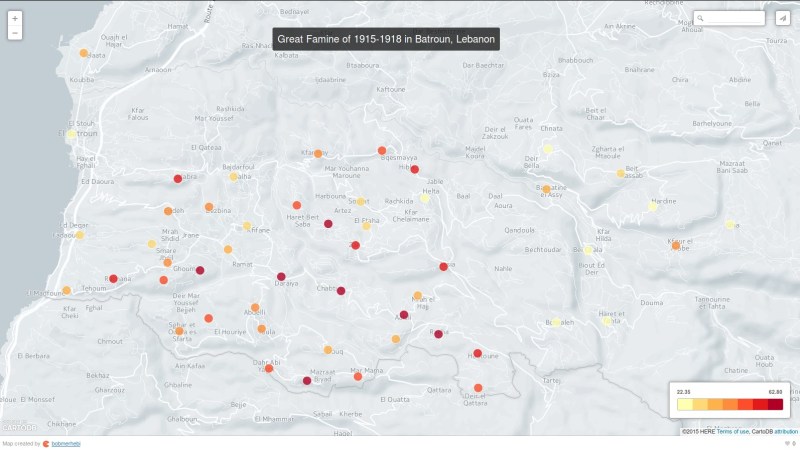
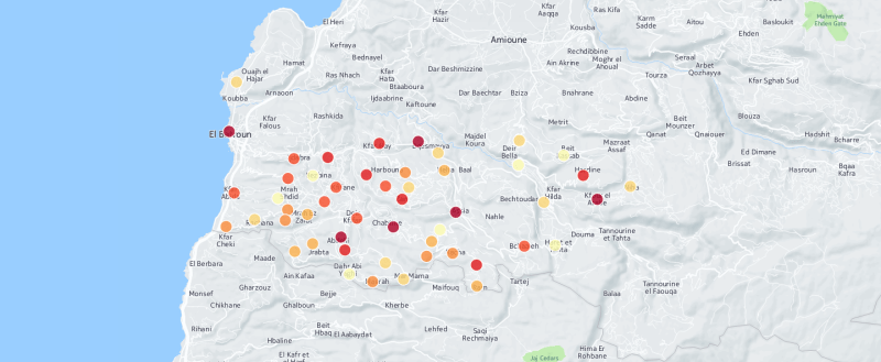
In a previous post I shared maps of the the number of dead in Batroun, Lebanon due the great famine of 1915. The maps have since been updated after normalizing the data so they display the “percentage” of dead. Below is the full story of the Great Famine.

The years 1915 to 1918 are considered one of the worst years in the history of Lebanon if not the Middle East. At the time the country was not known as Lebanon but was rather part of the Ottoman Empire. While many were dying on the front lines of the First World War in Europe the Lebanese were starving to death.

When the Ottoman Empire joined Germany in the war the allied powers enforced a maritime blockade on the Mediterranean to prevent any resources from reaching the empire. In return Jamal Pasha, appointed as minister of navy over Lebanon at the time, also enforced a similar blockade along the eastern Mediterranean to block supplies to the British in the Seuz Canal which also prevented any supplies from reaching the people of Lebanon. This was a major cause to the death of thousands. He came to be referred to as “Aljazzar” or “Alsaffah” which mean “the butcher” and “the blood shedder” due to his killings of Lebanese and Syrian people.

Continue reading

The 1915-1918 Famine of Batroun (Lebanon) Mapped

Standard

The following (bubble and choropleth, respectively) maps display the magnitude of people who died in Batroun (a city of northern Lebanon) during the 1915-1918 famine that hit Lebanon.

For extensive information on this famine I refer you to the French book “Histoire de la Grande famine au Mont-Liban (1915-1918) – Un genocide passe sous silence” by professor Antoine Boustany (ISBN: 9789953031194). You can find it at Librairie Antoine (order it online here).

Update: For the story see The Great Famine of 1915

Watch the Solar Eclipse LIVE

Link

Given the cloudy conditions here in Lebanon and to those who can’t take the safety precautions and those who want to watch the total eclipse (not 18% as in Lebanon):

Watch the solar eclipse live through

Tomorrows Solar Eclipse from Beirut

Standard

I have stumbled upon several posts and discussions on social networks, and some have contacted me about whether the eclipse is visible from Lebanon or not and about the timing.
I am writing this post to address some of your confusions. Here’s a general video from NASA’s Jet Propulsion Lab to start with:

Following is a visualization of the eclipse. The greatest eclipse (totality) occurs above the Faroe Islands, halfway between Norway and Iceland, around 1200 hours Beirut time.
In the visualization below, the strip formed by the two blue curves within which the greatest eclipse occurs is the path of totality. This is the path the shadow due to the moon blocking the Sun’s light from us follows. The further on Earth the observer is from this path the smaller the percentage of the eclipse is observed. Read on for more details.

Continue reading