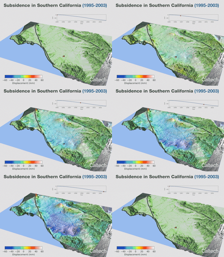
How Groundwater Extraction & Replenishing Causes Surface Deformation & Subsidence

Standard

Researchers at Caltech made the animations below which show the seasonal deformation and subsidence of Earth’s surface, respectively,  as a result of groundwater extraction and refilling. This occurs when soil and earth layers are compacted and undergo subsidence due to the decrease of upward hydrostatic pressure balancing the weight of the layers.

Surface deformation and subsidence of Earth’s surface is measured using Interferometric Synthetic Aperture Radar (ISAR). ISAR is also used for natural hazard assessment. This includes applications to regions of volcanic, tectonic (e.g. faults and mountains), and construction activities.


source: Caltech

Convolutional Neural Network for Oil Spill detection in Synthetic Aperture Radar Satellite Images

Image

Heisenberg’s Uncertainty Principle by Dr. Walter Lewin

Standard

A reminder of the basics of quantum mechanics.

An atom is all vacuum. You and I are all vacuum. You think of yourself of being something but we are nothing.

Colliding Fluids

Standard

At DTU Riso for the PhD Summer School on Remote Sensing for Wind Energy

Standard

Attending the PhD Summer School on Remote Sensing for Wind Energy at the Institute of Wind Energy at the Denmark Technical University (DTU Riso) in Roskilde, Denmark.

Day 1 focused on LIDARs. It included a walk to check out the historical met mast and a view of the wind turbines (see images).